Yiming Xu

and 6 more

Mapping the SOC distributions in coastal wetlands plays an important role in assessing ecosystem services, predicting the greenhouse effects and investigating global carbon cycle. Few research has explored the relationships of SOC and environmental variables with seasonal changes, and the effects of multi-temporal environmental variables on Digital Soil Mapping (DSM). The results showed that the relationships between SOC and environmental variables in different months varied significantly in coastal wetlands of the Yellow River Delta (YRD). In general, the environmental variables in wet season showed stronger correlations and higher importance scores with SOC compared with those in dry season. In addition, SOC prediction models based on multi-temporal data in wet season and mono-temporal data in April had stronger prediction performance compared with those based on multi-temporal data in dry season. As a result, data fusion of multi-temporal data did not necessarily contribute to the model performance enhancement. Relative homogenous soil-landscape attributes and spectral characteristics in coastal wetlands of the YRD in dry season could not accurately explain the strong spatial variation of SOC in this area, and it might be the major reason that caused the stronger model performance of soil prediction models based on wet season than those based on dry season. Therefore, the accurate spatial prediction of soil properties requires the characterization of the seasonal dynamics of soil-landscape relationships. In general, the findings of this research demonstrated that the selection of the environmental variables in the establishment of DSM model should consider the seasonal effects of environmental variables.

Zhaoning Gong

and 4 more

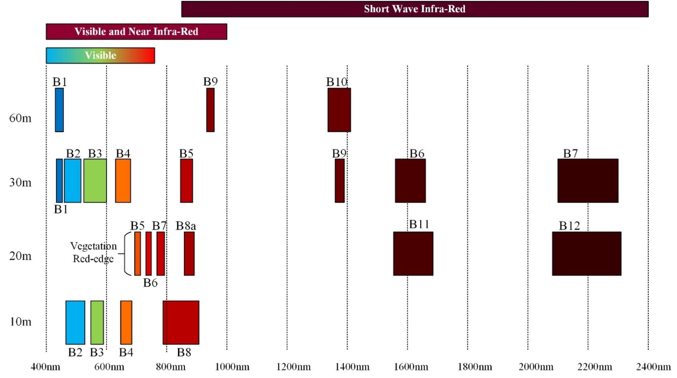
The native and invasive species in the Yellow River Delta were examined for their spatiotemporal characteristics and succession pattern. First, the appropriate Sentinel-2 and Landsat-8 images from 2018 were selected according to phenological characteristics. A random forest algorithm was used to verify the image spectral band significance and separability using selected images to determine the native and invasive species. Then, the spatiotemporal variation of habitat structure of native and invasive species is discussed in depth from the perspective of landscape ecology. Finally, the expansion direction and expansion mode of S. alterniflora were further analyzed, and main results were obtained as follows. (1) At the medium-high resolution multi-spectral image level, the accuracy of different vegetation community extractions can be improved by taking into consideration both the vegetation phenology and the spectral features of remote sensing images. (2) Sentinel-2 images with red edge bands have obvious advantages in vegetation community extraction as compared to Landsat-8 images (Sentinel-2, OA=82.86%, Kappa coefficient=0.79; Landsat-8, OA=78.77%, Kappa coefficient=0.74). (3) The expansion pattern of the S. alterniflora community became spatially continuous, more regularized and aggregated overtime. (4) The expansion in the north shore mainly faces to the sea, and the south bank mainly faces to the land, and this phenomena is closely related to the sedimentation of the Yellow River Delta. Marginal and external expansion both occurred, but marginal expansion predominated. The results from this study have important theoretical and scientific value for the environmental protection and sustainable development of the entire Yellow River Delta.